
Table of Contents
- What Is a Property Survey and Why Does It Matter?
- Key Types of Property Surveys Every Buyer Should Know
- How Accurate Surveys Protect Your Investment
- The Real Cost of Inaccurate Surveys
- Essential Survey Terms Explained Simply
- Common Survey Mistakes Buyers Make
- How to Choose the Right Real Estate Surveyor
- How Modern Survey Technology Benefits Buyers
- Frequently Asked Questions
- Commission Your Survey with Momoh Jimoh and Associates
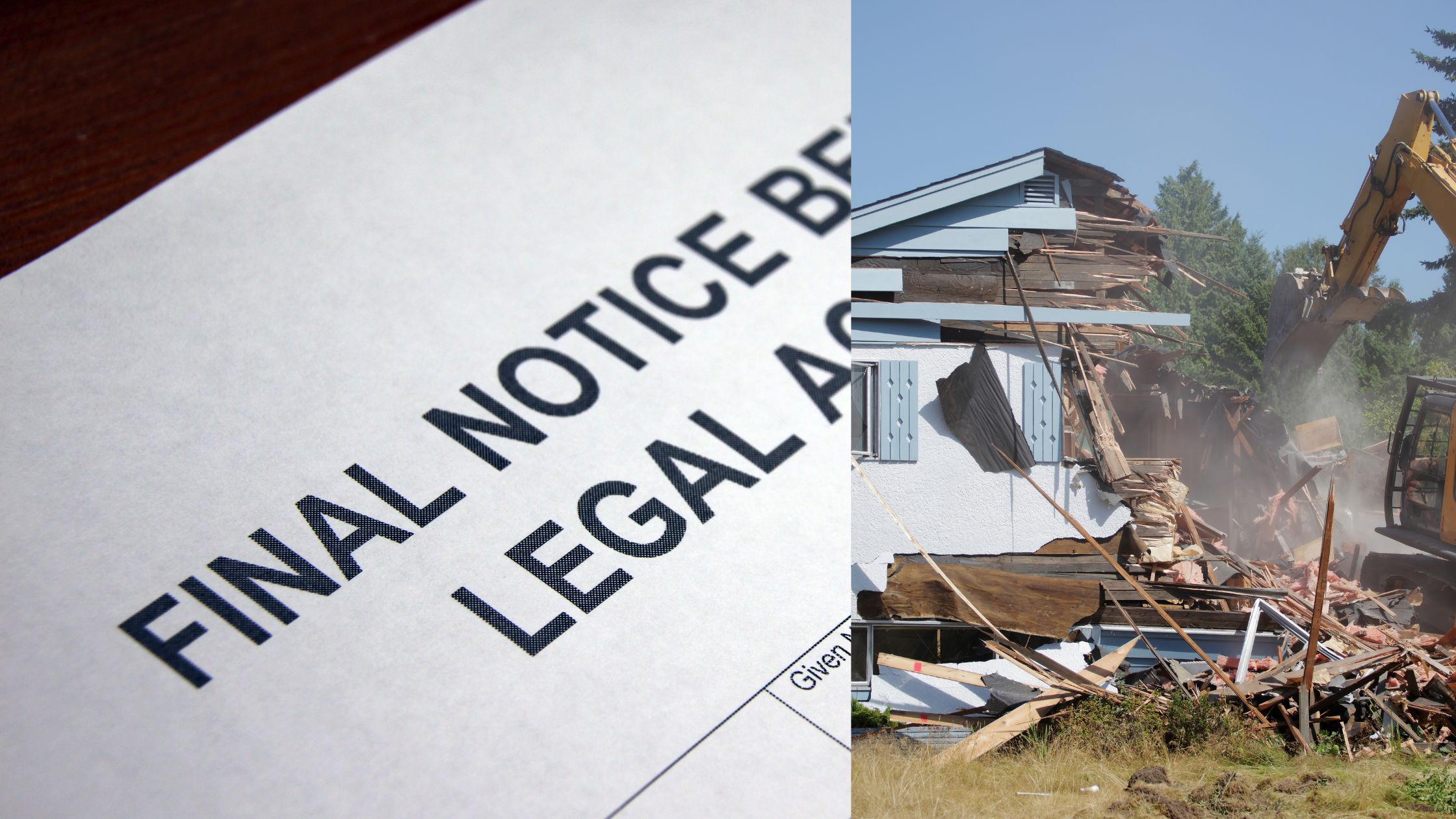
Somebody paid for a piece of land in Abuja last year. The documents looked clean. The seller was confident. A viewing was done. A price was agreed. Money moved. The buyer broke ground for construction three months later. Two weeks into building, a government official arrived on site and flagged the foundation. A major water pipeline ran directly beneath the proposed structure, protected by a legal easement. Construction stopped. The legal battle started. The money spent on groundwork went with it.
Nobody told the buyer to get an accurate property survey before signing.
This is not a rare story in Nigerian real estate. It is a pattern. Buyers trust what they can see. They trust sellers who speak confidently. They trust documents that look official. And then, when the truth surfaces, it surfaces at the worst possible time, which is after the deal is done and the money is gone.
A reliable property survey does not just describe a piece of land. It tells you the legal truth about what you are buying. It shows you the exact boundaries. It reveals hidden easements. It flags structural risks. And it gives you documented, certified information that no seller, no visual inspection, and no handshake agreement ever provides.
This guide covers everything you need to understand about accurate property surveys, why they matter, what the different types do, and how to get the right one before your next property purchase.
What Is a Property Survey and Why Does It Matter?

A property survey is a formal, certified process conducted by a registered professional to measure, map, and document the exact physical and legal characteristics of a piece of land or building. It covers the precise boundaries of the property, the location of existing structures, any access rights attached to the land, and the legal restrictions that apply to it.
The purpose of an accurate property survey is not to describe what a property looks like. It is to confirm what the property legally is. Two plots can look identical to the naked eye. Their surveys will almost never be.
For buyers, this distinction is critical. The asking price is based on what the seller presents. The survey report is based on what the law and physical measurement confirm. When those two things do not match, the survey is the one that is right.
In Nigeria, property surveys are conducted by registered Estate Surveyors and Valuers who are licensed by the Nigerian Institution of Estate Surveyors and Valuers (NIESV). Their reports are legally recognized by courts, financial institutions, government agencies, and mortgage lenders. This means the information in a certified survey report is not just useful. It is admissible and enforceable.
A survey report for property purchase is not a luxury for cautious buyers. It is a professional standard that every buyer, regardless of experience, should insist on before completing any transaction.
“A survey does not tell you what a property looks like. It tells you what it legally is. And in real estate, what it legally is will always matter more than how it looks.”
– Market Wisdom
Key Types of Property Surveys Every Buyer Should Know
Not all surveys serve the same purpose. The type of survey you need depends on the property you are buying and what you intend to do with it. Here are the primary types and what each one does.
Boundary Survey
This is the most common type of accurate property survey used in residential transactions. A boundary survey establishes the precise legal perimeter of a piece of land. The surveyor uses precision instruments to measure the land and cross-references the physical measurements against the original land registry records.
A property boundary survey is essential before buying any land or building. It tells you exactly where your ownership begins and ends. Without it, you are relying on the seller’s interpretation of the boundary, which may be incorrect, outdated, or deliberately misleading.
Topographic Survey
A topographic survey maps the elevation and contour of the land. It shows the rises, slopes, drainage directions, and natural features of the terrain. This survey is not focused on legal boundaries. It is focused on the physical character of the ground itself.
For buyers planning to develop, build, or significantly landscape a property, a topographic survey is essential. It tells you how rainwater flows across the land, where flooding risks exist, and whether the terrain supports the type of construction you are planning. Building on land without this information has led to flooded basements, collapsed retaining walls, and drainage failures across Nigeria.
ALTA Survey (Comprehensive Title Survey)
An ALTA survey, which stands for American Land Title Association, is the most detailed type of property survey available. It is primarily used for commercial property transactions and large-scale land acquisitions. It covers everything a boundary survey provides, plus existing structures on the land, access rights, recorded easements, utility lines, zoning classification, and any encroachments.
For investors acquiring commercial plots, industrial land, or large estates, this level of detail is non-negotiable. The information it provides protects against every category of legal and structural risk in a single report.
Structural Survey
For buyers purchasing an existing building, a structural survey examines the physical integrity of the structure itself. This is separate from a boundary survey. Where a boundary survey deals with land, a structural survey deals with the building on it.
The surveyor inspects the foundation, roof structure, walls, drainage systems, electrical installations, and plumbing. Sellers routinely use fresh paint, new flooring, and cosmetic renovations to conceal serious structural faults. A structural survey looks past the surface and reports the condition of what holds the building together.
How Accurate Surveys Protect Your Investment

Preventing Boundary Disputes
Property boundary disputes are one of the most common and most expensive legal problems in Nigerian real estate. They arise when two parties disagree about where one party’s property ends and the other’s begins. Without a formal survey, these disagreements are resolved through long, costly court battles that can freeze your ability to develop or sell the land for years.
An accurate property boundary survey eliminates this risk entirely before you commit your money. It establishes the legal coordinates of your land with certified precision. If a neighbor’s fence sits inside your boundary, you know before you buy. If the plot is smaller than the seller advertised, you know before you sign.
Protecting You from Fraudulent Title Documents
Title fraud is a serious and documented problem in Nigeria’s property market. Some sellers present forged or duplicated title documents for land they do not legally own, or land whose ownership is disputed. An accurate survey, combined with a land title verification check, confirms that the documents match the physical reality of the land and that the ownership chain is clean.
A buyer who skips this step has no protection against fraudulent documentation. A buyer who commissions a full survey and title check has a legally certified record of due diligence that protects their position in any dispute.
Strengthening Your Negotiation Position
Every finding in a survey report is leverage. If the survey reveals that the land is smaller than advertised, the price must reflect the actual size. If structural defects are found, repair costs factor into the negotiation. If easements restrict a significant portion of the usable land, the value of the property changes accordingly.
Sellers price properties based on what they want. A certified survey report grounds the negotiation in what the property actually is. Most buyers who commission a survey before negotiating recover a multiple of the survey fee through the price reductions they negotiate.
The Real Cost of Inaccurate Surveys
Inaccurate survey consequences in real estate are not theoretical. They are financial, legal, and deeply personal.
Legal Costs and Prolonged Disputes
When a survey error is discovered after a transaction closes, resolving it requires lawyers, court processes, and time. Boundary corrections, encroachment removals, and easement disputes in Nigeria take months to years to resolve through formal legal channels. Every month of that dispute costs money in legal fees and costs you the ability to use, develop, or resell the property.
Mortgage and Financing Complications
Nigerian banks and mortgage institutions require a certified survey report before approving property-backed financing. If the survey on record contains errors, the financing process stalls or collapses entirely. An inaccurate survey can also lead to insurance claims being denied. Insurers underwrite policies based on the legal boundary and structural condition of the insured asset. If those details are wrong on paper, the insurer has grounds to reject a claim.
Loss of Usable Land or Building Rights
Easement errors and zoning misclassifications in an inaccurate survey result in buyers losing the right to build on portions of land they have already paid for. In some cases, structures already built in violation of an easement must be demolished at the buyer’s own expense. These are not small costs. They often run into millions of naira.
The professional fee for a certified survey is a fraction of any one of these potential losses. It is the most cost-effective risk management tool available to a property buyer.
Essential Survey Terms Explained Simply
Real estate surveys use specific technical and legal terms. Understanding them before you read your survey report prevents confusion and ensures you act on the right information.
Easement
An easement is a legal right that gives a third party access to a specific portion of your property for a defined purpose. Government bodies hold easements over land where public utilities like water pipes, gas lines, or power cables run. The easement means you own the land but cannot build over or obstruct that corridor. An accurate property survey identifies every registered easement on a plot before you buy.
Encroachment
An encroachment occurs when a structure from one property crosses legally into an adjacent property. This includes fences, walls, extensions, and even trees whose roots affect a neighboring foundation. Encroachments discovered before a purchase give the buyer the option to have them resolved before closing or walk away entirely. Encroachments discovered after a purchase become the buyer’s legal and financial problem to resolve.
Right of Way
A right of way is a specific type of easement that allows people or vehicles to pass through a portion of your land. Roads, footpaths, and access routes through private property are common examples. Buying land with an unrecorded right of way and then attempting to block it leads directly to legal disputes with the parties who have used that route, sometimes for decades.
Benchmark and Survey Pin
A benchmark is a fixed reference point used by surveyors to establish elevation measurements. A survey pin is a physical marker, usually a metal rod, placed in the ground to mark the exact corner of a property boundary. When you take possession of land, confirming that all survey pins are in place ensures that the boundary you paid for is the boundary you own.
“The difference between a buyer who understands their survey report and one who does not is the difference between owning what they paid for and fighting for it.”
– Market Wisdom
Common Survey Mistakes Buyers Make
Understanding what a survey does matters. But knowing what buyers consistently get wrong is equally important.
Relying on an Outdated Survey
An old survey report does not reflect the current legal or physical state of a property. Boundaries can be formally redrawn. New easements get registered. Neighboring structures get built in ways that affect your land. A survey conducted several years ago does not account for any of these changes. Always request a fresh, current survey commissioned specifically for your transaction.
Not Reading the Survey Report
Many buyers receive a certified survey report and file it away without reading it. This defeats the entire purpose. The survey report is a working document. It contains findings that may require action before the deal closes, including requests for boundary corrections, easement disclosures, or structural repairs. If you do not read it, you lose the protection it provides.
Hiring an Unregistered Surveyor
In Nigeria, only registered Estate Surveyors and Valuers licensed by NIESV are authorized to produce legally recognized survey reports. Hiring an unregistered individual to conduct a survey produces a document that no bank, court, or government agency will accept. It also increases the risk of significant technical errors that go undetected until the damage is done. Always verify that the surveyor you hire holds a valid license.
Accepting the Seller’s Survey
Some sellers offer to provide the survey themselves to speed up the transaction. This is a conflict of interest. A survey report should be commissioned independently by the buyer, from a surveyor chosen by the buyer. When the seller controls the survey process, the independence of the findings is compromised. Your survey should represent your interests, not the seller’s.
How to Choose the Right Real Estate Surveyor

The accuracy of your survey is only as strong as the professional conducting it. Choosing the right surveyor is not a minor administrative step. It directly determines the quality and legal standing of the information you receive.
Verify Their Registration
Before engaging any surveyor, confirm that they are registered with the Nigerian Institution of Estate Surveyors and Valuers (NIESV) and hold a valid practicing license. Registration confirms that the professional meets national standards of training, ethics, and technical competence. A registered surveyor also carries professional indemnity, which protects you if an error in their report causes financial loss.
Check Their Experience with Your Property Type
Surveying a residential plot in a suburban estate is different from surveying a commercial complex or an industrial property. Confirm that the surveyor has direct experience with properties similar to yours, in terms of type, size, and location. An experienced surveyor in your specific property category will identify risks that a generalist might overlook.
Ask Specific Questions Before Hiring
The right surveyor welcomes scrutiny. Ask them which survey method they will use and why. Ask about their turnaround time for the report. Ask whether they have worked on properties in the specific area where your target property sits. Ask how they handle boundary disputes if one is identified during the survey. Their answers will tell you whether they are the right professional for your transaction.
Prioritize Independence Over Convenience
The most important quality in a surveyor is independence. They must have no prior relationship with the seller, the seller’s agent, or any party with a financial interest in the transaction closing. An independent surveyor reports what they find, not what speeds up the deal.
How Modern Survey Technology Benefits Buyers
The tools available to today’s professional surveyors have changed significantly, and those changes directly benefit the buyers who commission their work.
GPS and Total Station Equipment
Modern surveyors use GPS receivers and total station instruments that measure distances and angles with millimetre-level precision. These tools eliminate the human measurement errors that plagued older surveying methods. The result is a property boundary survey with a level of accuracy that protects buyers against even the smallest discrepancy in recorded boundary positions.
Drone Aerial Surveys
Drone technology allows surveyors to capture detailed aerial photography and video of a property and its surroundings in a fraction of the time required by traditional methods. For large plots, commercial land, or properties in hard-to-access terrain, drone surveys provide a comprehensive overhead view that supports more accurate topographic and boundary analysis. Buyers benefit from faster turnaround times and a more complete picture of the land they are evaluating.
3D Mapping and Digital Survey Reports
Advanced software now allows surveyors to generate three-dimensional models of a property’s terrain and structures. These models give buyers an intuitive, visual representation of the land that goes far beyond a flat paper map. Digital survey reports also allow for easier storage, sharing with legal and financial advisors, and comparison against future surveys if boundary disputes arise.
Technology does not replace the judgment of a skilled, experienced surveyor. But in the hands of a registered professional, these tools produce survey reports that are more accurate, more detailed, and more legally defensible than anything produced a decade ago.
Frequently Asked Questions
What happens if an inaccurate survey is discovered after I complete my purchase?
Discovering survey errors after a transaction closes means the resolution process becomes your burden entirely. You would need to commission a corrective survey, engage legal counsel, and potentially seek compensation from the seller or the original surveyor. These processes are costly and slow. This is why an independent, accurate property survey commissioned before closing is non-negotiable.
Are surveys legally required for all property transactions in Nigeria?
While Nigerian law does not always mandate a survey as a condition of sale for every transaction type, mortgage lenders, insurance providers, and land registration bodies all require a valid survey report. More importantly, the absence of a survey does not protect you from the legal risks it would have revealed. The risk exists whether or not a survey was done. Getting one ensures you know about that risk before you are financially committed.
What is the difference between a survey and a valuation?
A property survey measures and maps the physical and legal characteristics of a piece of land or building. It tells you exactly what you are buying and what legal restrictions apply. A property valuation determines the financial worth of the property at a specific point in time. Both are important before a purchase. They are complementary, not interchangeable. A valuation tells you if the price is fair. A survey tells you if the property is legally and physically what it claims to be.
How do I know if an easement affects the part of the land I want to build on?
A certified property boundary survey or ALTA survey will map every registered easement on the land and show you its exact location relative to the property boundaries. Once the surveyor marks the easement corridor on the survey plan, you will know exactly which portions of the land are restricted for construction.
Can I use the same survey for a mortgage and for my personal records?
Yes. A certified survey report produced by a registered Estate Surveyor and Valuer is accepted by Nigerian banks for mortgage purposes, by government bodies for land registration, and by courts in the event of a boundary dispute. One report, when produced to the required standard, serves all of these purposes.
Commission Your Survey with Momoh Jimoh and Associates
The gap between a good property purchase and a costly mistake is not always visible. It is in the documents. It is in the boundaries. It is in the easements and restrictions that no site visit reveals. An accurate property survey closes that gap before you commit your capital.
Momoh Jimoh and Associates is a registered real estate firm that has been conducting certified property surveys across Nigeria since 2008. The firm is a Fellow of the Nigerian Institution of Estate Surveyors and Valuers (FNIESV) and is registered with the Royal Institution of Chartered Surveyors (RICS), the American Society of Appraisers, the African Real Estate Society, and the International Valuation Standards Council. Every survey report produced by the firm meets both national and international professional standards.
What the Firm Provides
The team conducts property boundary surveys for residential and commercial land, structural surveys for existing buildings, topographic surveys for development planning, and comprehensive land verification checks for buyers concerned about title authenticity. Survey reports are delivered with certified accuracy and are accepted by Nigerian banks, mortgage lenders, insurance institutions, and government bodies.
For buyers who need both a survey and a valuation before completing a purchase, the firm handles both services, giving you a complete, legally recognized picture of the property you are considering.
The Land Verification Service
One of the firm’s most accessed services is its dedicated land verification offering. This service is specifically designed for buyers in Nigeria who want to confirm that a property’s title documents are authentic, that the ownership history is clean, and that no undisclosed disputes are attached to the land. In a market where fraudulent documentation continues to trap buyers, this verification service provides an independent, certified confirmation before any money moves.
Getting Started
Contact the team through momohjimohassociates.com or send a property request directly. The team responds within 24 hours. A registered surveyor is assigned to your case, a site visit is scheduled, and your certified survey report is delivered within the agreed timeline.
Do not close a property deal on trust alone. A certified, accurate property survey from a registered professional is the standard that every smart buyer holds to before signing. Visit momohjimohassociates.com today and commission yours.
Buying property without an accurate survey is like trying to teach without having a topic. Risky right!
If you’re serious about protecting your investment, an accurate survey is essential.
Talk to a qualified surveyor today at Momoh Jimoh and Associates, and buy with confidence, not crossed fingers.

Join The Discussion